
NEW PRODUCT
NEW PRODUCTS
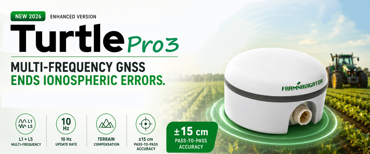
Turtle Pro3: the right level of precision,
where it really matters
In precision agriculture, centimetre-level accuracy and RTK are increasingly at the centre of the conversation. But not every agricultural operation requires two-centimetre accuracy. For many tasks, what really matters is having a position that is stable, reliable and repeatable during field operations, without adding unnecessary cost and complexity.
This is exactly where Turtle Pro3 fits: the FARMNAVIGATOR GNSS receiver based on the new u-blox F10 platform.
KEY FEAUTERES
Multi-frequency L1, L5 reception cancels ionospheric errors for a more reliable
More accurate signal than Turtle Pro2 — 10 Hz update rate
Terrain Compensation
±15 cm pass-to-pass accuracy
Frequency
Multi L1, L5
Update Rate
10 Hz
Accuracy*
± 15 cm
* Pass-to-pass
MOTION SENSORS
Terrain Compensation
L1 + L5: a more robust GNSS solution
One of the key features of Turtle Pro3 is its ability to use L1 and L5 frequencies simultaneously.
The advantage is not simply having “one more frequency”. L5 is a new-generation GNSS signal characterised by a wider bandwidth and a code rate ten times higher than traditional GPS L1 C/A. This allows the receiver to better distinguish the direct satellite signal from reflected signals, reducing sensitivity to multipath, one of the main error sources affecting standalone GNSS receivers.
This is particularly relevant in agricultural environments.
Referenced Study — IEEE, 2026
A 2026 study published in IEEE Transactions on Instrumentation and Measurement, Analysis of GNSS Multipath Effects and Performance Degradation in Vegetated Environments, investigated what happens to satellite signals in areas with significant vegetation.
Here, a vegetated environment does not simply mean an open cultivated field. It refers to situations where GNSS signals travel through, or close to, tree canopies, leaves, branches and trunks. In agriculture, this can occur when working in or near orchards, tree rows, hedges, field boundaries with trees or woodland areas, where part of the sky can be obstructed by vegetation.
The study shows that under these conditions, the direct signal from the satellite can be attenuated, while leaves, branches and other vegetation structures generate reflections and scattering. As a result, the receiver may simultaneously detect the correct direct signal and delayed replicas travelling along different paths, reducing positioning quality.
The researchers directly analysed GPS L1 and L5 signals and highlighted an important difference: the L5 code has a chip length approximately ten times shorter than the traditional L1 code. This higher resolution makes it easier to identify short-delay reflected components, including those generated within vegetation, which are much more difficult to separate when using conventional L1 signals alone.
This is one of the reasons why the L1 + L5 combination represents a significant improvement over traditional L1-only GNSS receivers. It does not turn a standalone receiver into an RTK system, but it can make positioning more robust under real operating conditions, particularly when satellite visibility is not ideal..
It is not RTK — and it is not intended to be
Turtle Pro3 does not use RTK corrections. Its positioning therefore needs to be clearly understood: it is not designed for applications requiring absolute centimetre-level accuracy or for accurately repeating the same trajectory days or months later.
RTK remains the reference technology whenever positioning accuracy of just a few centimetres is required. Standalone GNSS or SBAS-assisted systems, on the other hand, typically operate at an accuracy level of several tens of centimetres, which is entirely suitable for many agricultural operations.
Experimental studies on agricultural machinery clearly show this distinction between the two technology levels.
RTK
The reference technology whenever positioning accuracy of just a few centimetres is required — repeatable trajectories, absolute centimetre-level accuracy.
Standalone GNSS
±15 cm pass-to-pass accuracy at 10 Hz update rate — well suited to fertiliser spreading, spraying, soil preparation and other tasks where RTK centimetre-level accuracy is not essential.
Turtle Pro3 has been developed specifically for this segment and provides pass-to-pass accuracy down to ±15 cm, with a 10 Hz position update rate. It is therefore well suited to operations such as fertiliser spreading, spraying, soil preparation and other field tasks where accurate and stable guidance helps reduce overlaps and untreated gaps, but where RTK centimetre-level accuracy is not essential.
GNSS is only part of the system
Turtle Pro3 doTurtle Pro3, however, is much more than a new satellite receiver.
It integrates an inertial measurement platform, combined through AvMap’s proprietary GNSS + IMU sensor-fusion technology.
The system continuously combines satellite positioning data with information about the vehicle’s movement and attitude. This enables highly accurate estimation of pitch and roll, compensating for tractor inclination, while also providing a stable and responsive heading even at the low speeds typically encountered during agricultural operations.
This is a fundamental point: in the field, knowing where the tractor is located is not enough. The system also needs to understand how the vehicle is moving and its actual orientation, particularly on slopes, uneven terrain or during low-speed manoeuvres.
L1 + L5 for more robust positioning, GNSS + IMU to understand the actual movement of the machine, and the level of precision needed to get the job done — without adding what is not needed.
Turtle Pro3 therefore follows a very clear philosophy: not to replace RTK where RTK is required, but to bring significantly more advanced GNSS technology to the many agricultural applications where centimetre-level accuracy is unnecessary.
SUGGESTED USE
Ideal for manual and automatic steering on basic precision activities — mapping, fertilizing, spraying and manuring — where ±15 cm accuracy is all it takes, without paying for RTK precision the job doesn't require.
Scientific reference: D. Hai, C. L. A. Tsang, G. Zhang, "Analysis of GNSS Multipath Effects and Performance Degradation in Vegetated Environments," IEEE Transactions on Instrumentation and Measurement, 2026, DOI 10.1109/TIM.2026.3709404..
Get in touch with FARMNAVIGATOR
Pricing · Distributor conditions · Sales materials